Use for trip planning, not navigation
NOAA Booklet Charts; a reduced scale NOAA nautical chart for small boaters. Numerous charts here.
This Official NOAA site allows users to print out on an home printer detailed navigational charts by printing the chart on multiple pages.
Useful for the Central Coast of California are
NOAA Chart 18703 (Estero Bay) and
NOAA Chart 18704 (San Luis Obispo Bay - Port San Luis)
Geo Garage; This site provides on-line charts for many areas of the world. It allows the user to zoom in on an area and then create a .pdf chart of that area.
Other Charts
NOTE: Some of the charts on this page were created by a DeLorme Earthmate PN-20 GPS and Topo 7.0 software. All charts/maps are intended for trip planning, not off-shore navigation. I provide them as-is with no claim to accuracy. Use them at your own risk.
Ocean
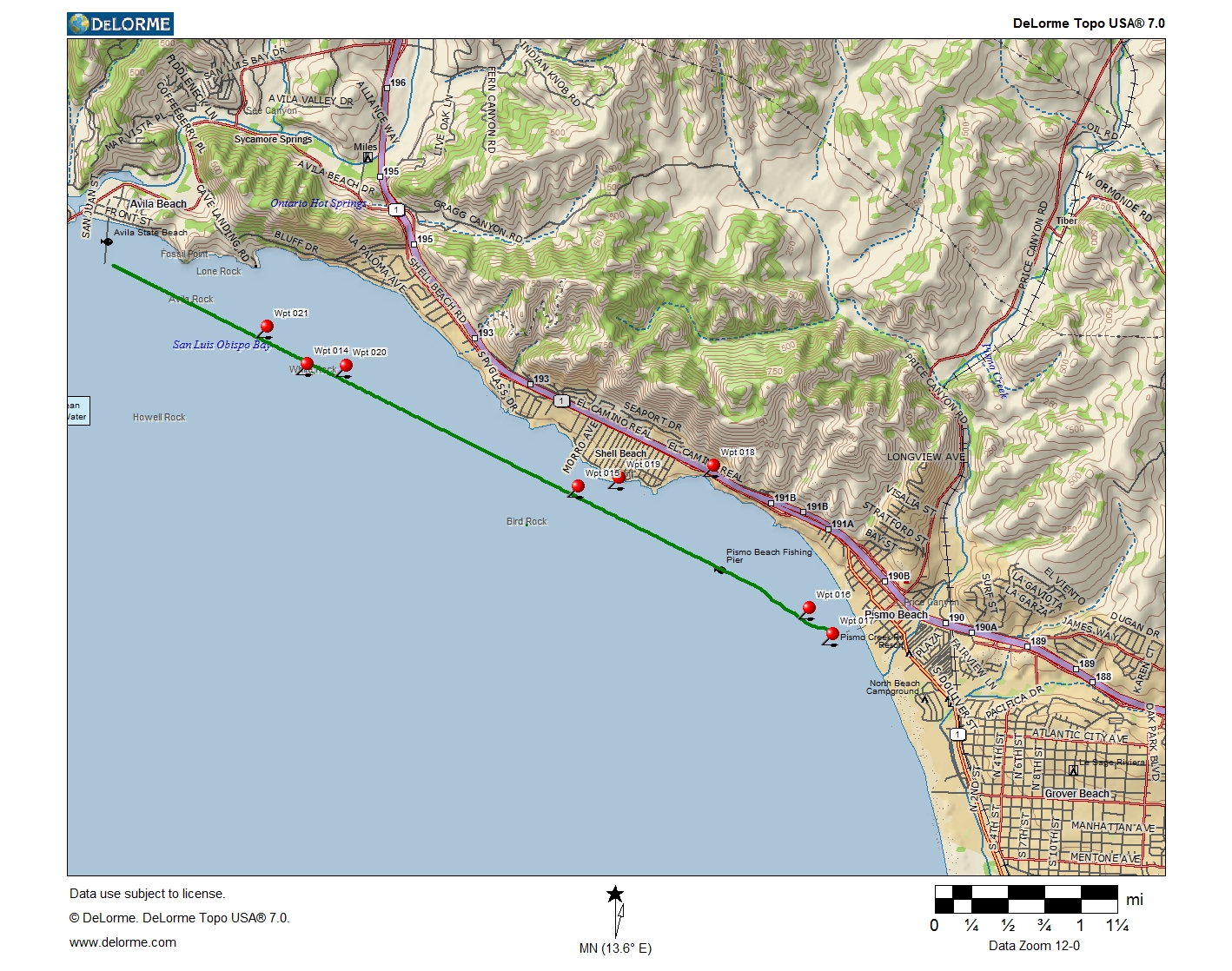
Avila Beach to Pismo Beach, California (1.0 Mb download)
Port San Luis to Pirates" Cove, California (.44 Mb download)
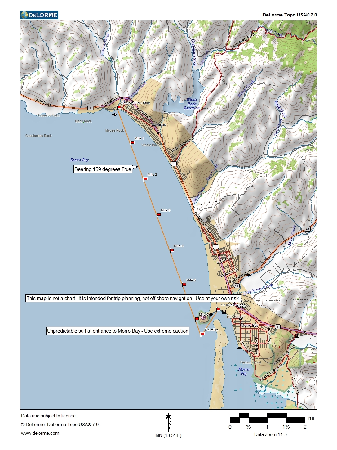
Cayucos to Morro Bay, California (.81 Mb download)
Guadalupe Dunes to Point Sal State Beach (with one mile markers) (1.0 Mb download)
Lower Morro Bay (1.43 Mb download)
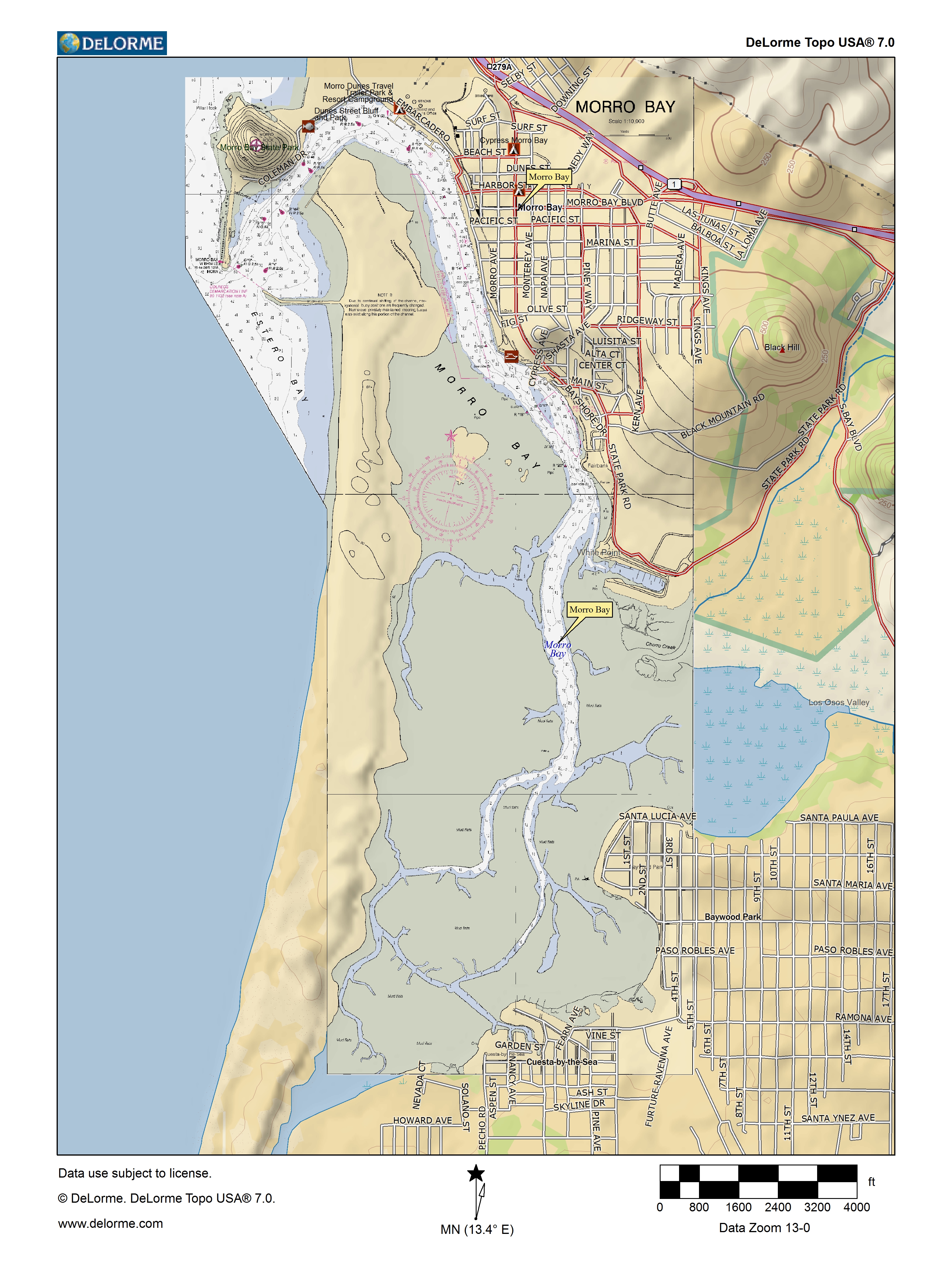
Upper Morro Bay (1.48 Mb download)
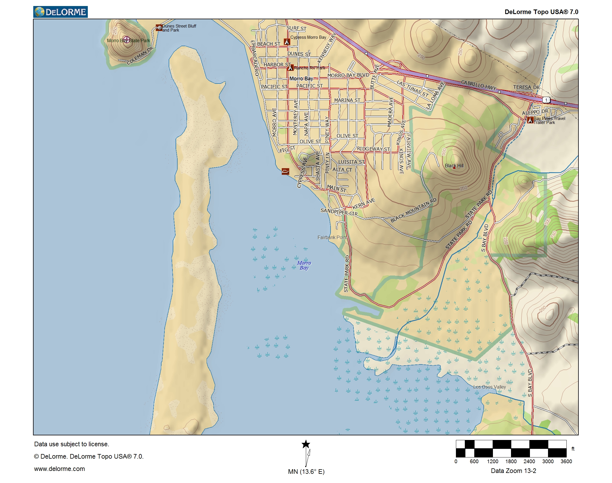
Map of Morro Bay, CA (5.2 Mb download)
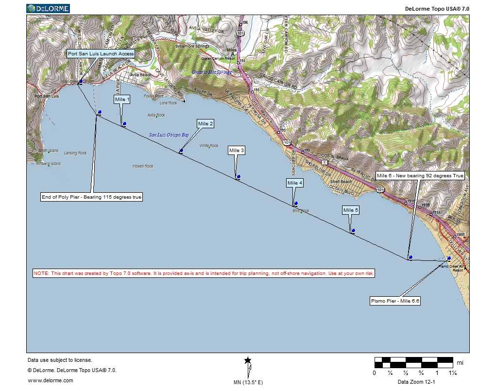
Port San Luis to Pismo Pier (.6 Mb download)
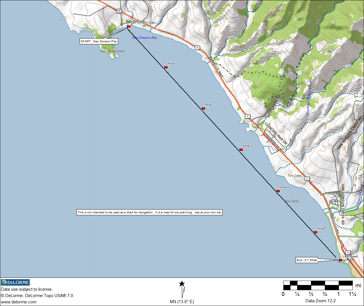
San Simeon to Leffingwell (with one mile markers) (.77 Mb download)
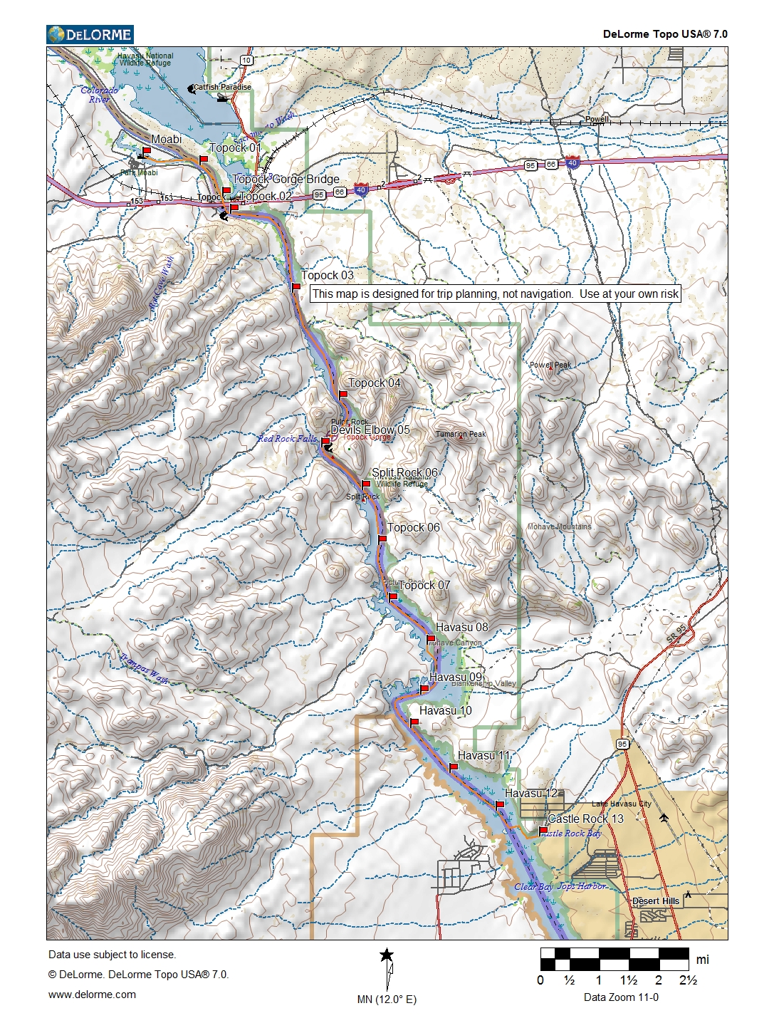
Topock Gorge to Castle Rock Arizona (with one mile markers) (1.42 Mb download)
Lakes
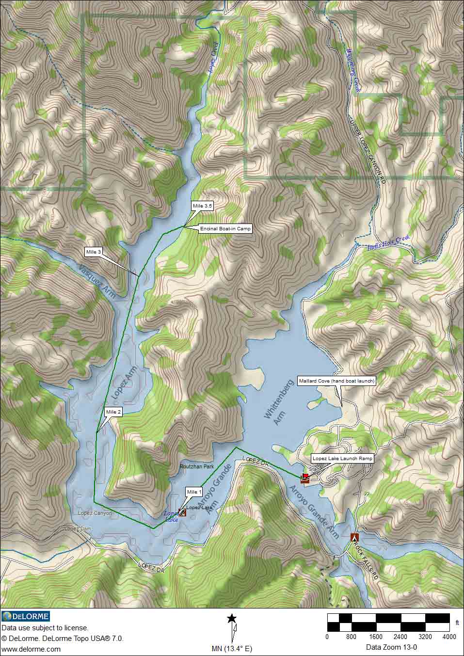
Lopez Lake (.253 mb download)
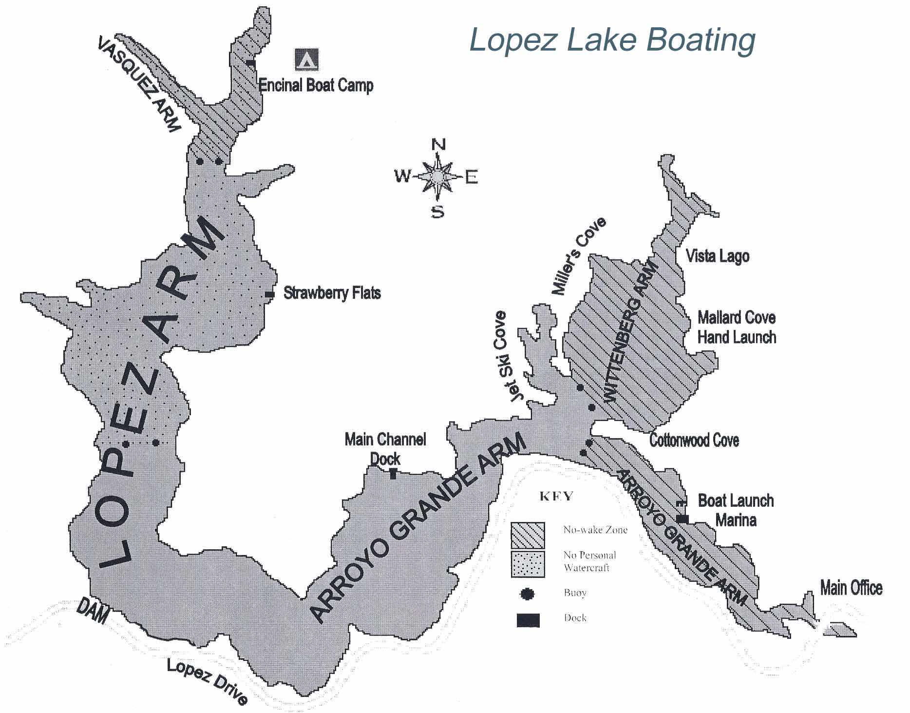
Lopez Lake Boating (.25 Mb download) map from SLO County Parks and Recreation
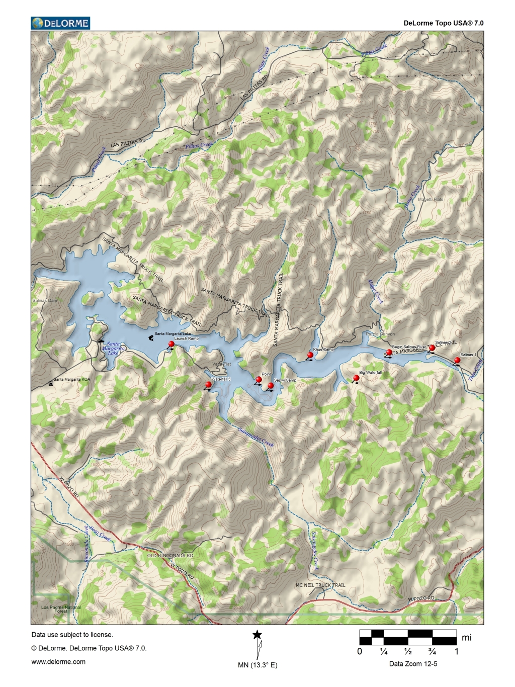
Santa Margarita Lake (1.01 Mb download)
Other Resources
Google Earth Pro Maps of my kayaking trips
Click here to download the kmz file.
If you have Google Earth Pro installed on your computer, it will automatically open that program, placing my files in the Temporary folder.
If you need Google Earth Pro, download that free program from https://www.google.com/earth/versions/#download-pro
TopoWeb Topographical Map Reading Tutorial
Export GPS Waypoints from DeLorme Topo 7.0 (Earthmate) to Vantage Point (Magellan Explorist)
Out of Area
Sacramento River Map; Route of the California River Quest Paddle from Redding to Chico
![]()
![]()
Copyright © 2019 by Ralph Sutter. All Rights Reserved.
Please send your comments regarding this site to Ralph Sutter, ralph@rsutter.com